
Trusted data quality
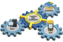 Because business decisions are only as good as the data available, Trimble ensures that GNSS data collected in the field is complete with the three key dimensions of field data—geometries, attributes, and metadata—to give you the confidence your work is on the mark. These complementary data sets are maintained for you throughout your entire workflow, so you can focus on getting more work done.
Because business decisions are only as good as the data available, Trimble ensures that GNSS data collected in the field is complete with the three key dimensions of field data—geometries, attributes, and metadata—to give you the confidence your work is on the mark. These complementary data sets are maintained for you throughout your entire workflow, so you can focus on getting more work done.
- Integrated synchronization between field and office enables streamlined connections that are quick and efficient.
- Define accuracy requirements to ensure certainty of the location of all assets.
- Use of offsets to capture features in challenging physical environments.
- Use accuracy based logging for the greatest confidence in your data before leaving the field.1
- Correct and verify so only qualified data is updated to the GIS. At a single button press, each update adds value making the geodatabase more reliable and useful.
- All positions are accompanied by Trimble GNSS metadata to track the pedigree of the data.
Complete your work with total confidence
Confidence is also measured by the consistency and efficiency of your team’s output each day. That’s why Trimble makes it easy for you to manage your complete field data collection operation.
- Reduce complexity in the field by configuring your data collectors for consistent results across your whole team.
- Simple workflows and feedback guide field workers through even the most complex data collection tasks. You don’t need GNSS or GIS experts to get predictably superior results.
- Manage the corrections you use—both real time and postprocessed
- Control and pre-configure for better data consistency with correction source management that is simple and easy to access.
- Use postprocessing profiles to efficiently ensure data is of the highest quality every time.
- Work wirelessly and synchronize to get data directly and quickly to the GIS.
- Full utilization of the Trimble data collection portfolio. Leverage Trimble Floodlight™ satellite shadow reduction technology for more GNSS positions and increased accuracy in tough GNSS environments. Utilize Trimble RTX™ correction services for autonomous, real-time differential GPS. Work with offsets and rangefinders—capture remote measurements in situations where previously it would be impractical or unsafe to do so. A full range of rugged devices is available to meet the needs of almost any application.
Trimble Positions software suite provides you with a streamlined choice for integrating high-performance field data collection into the Esri ArcGIS environment, so you can work smart and with the confidence you need today and tomorrow.
1 Not available with Esri ArcPad workflows.
Key Features
- Trusted data quality
- Complete your work with total confidence
Download Spec Sheet – English (pdf)
Download Spec Sheet – Spanish (pdf)